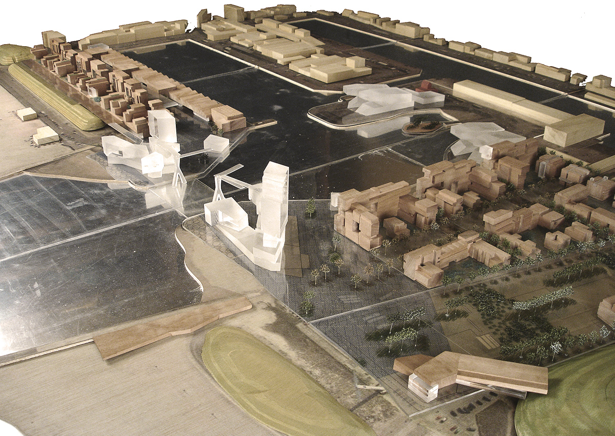
Scheveningen
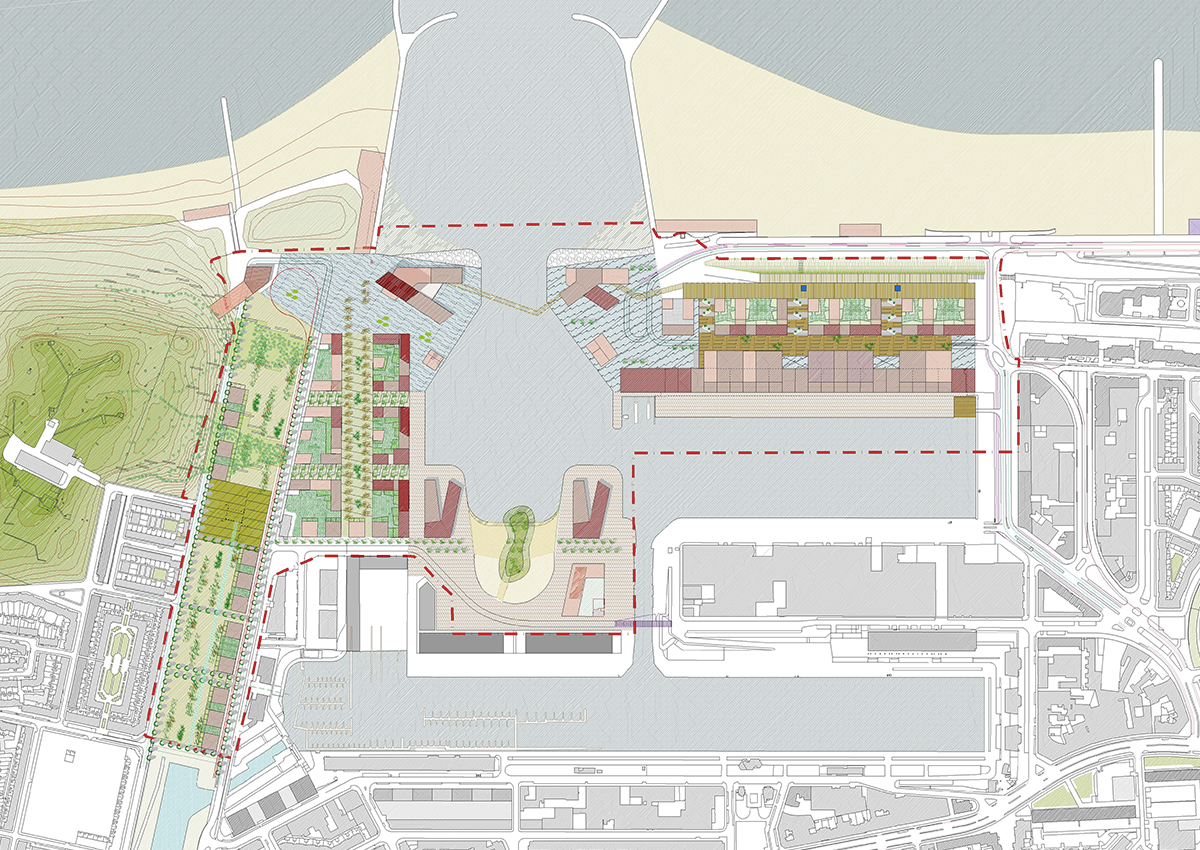
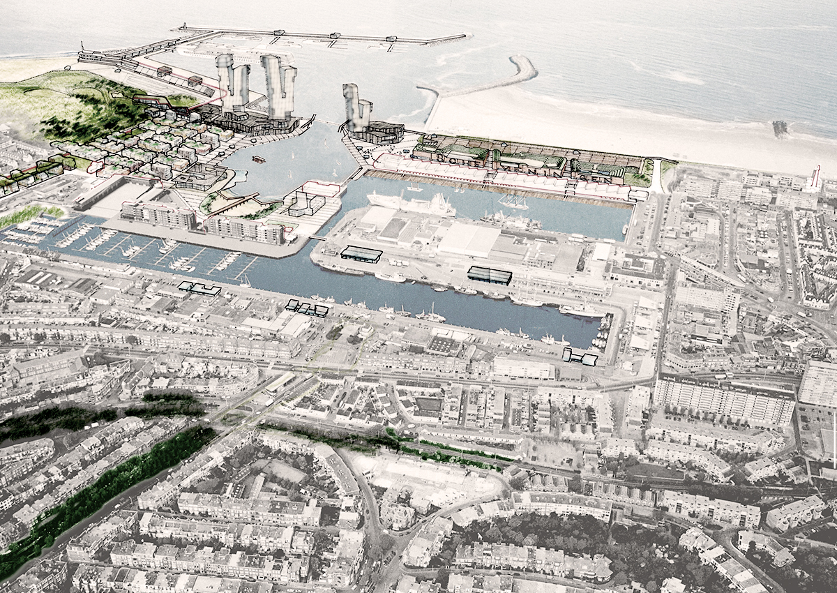
A priority objective of this Masterplan proposal is to establish the continuity of the dunes within the natural geographical system of the waterfront, whilst maintaining port activity. In order to do so, it will seek a system of constructions and activities that will allow pedestrians to walk from dune to dune, while enjoying the activities in the harbour.
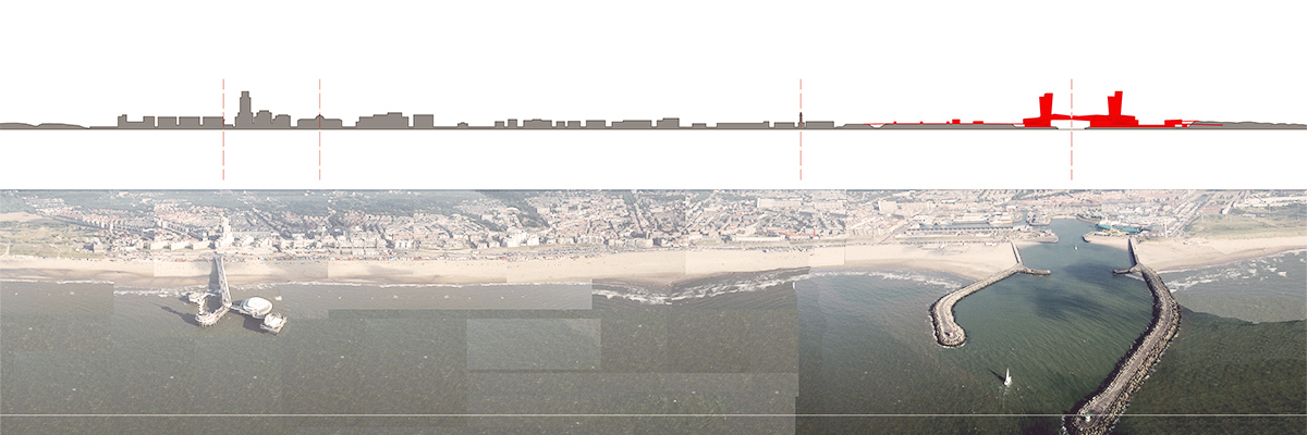
Within the environment/setting defined by these macro-geographical objectives, we saw the dune front as the natural space of the beaches, its rhythm marked by landmarks such as the pier or the harbour breakwaters. Here we realize that the use of sand and beaches is wide and has varied according to changing demands and cultural and sporting traditions over the decades. Therefore, it seemed to us that the more permanent sports facilities that require services could be implanted “above and behind” the dunes, as outlined in section 8 with the presentation of the NHH sector. Nevertheless, the stretch of sand could accommodate volleyball facilities, small kiosks, and so on, though always considered as transitory and/or provisional elements.
The flows, both maritime and land-based, have different levels of interaction, activating either regional, local or international networks.
The proposed urban structure tends to reinforce and improve what already exists, creating an easier access to the port for the users. We therefore propose to extend the tram, buses and possibly the Randstad Rail to the museum, the beach and the congress centre. Cycling and pedestrian routes flow smoothly from the surrounding districts in a spatial relationship that seems fundamental to the redeveloped harbour becoming a shared place for present-day and future residents and visitors.
The programme places great emphasis on parking space, building car parks underground or concealed from the urban scene to reduce their role in the public space. The layout/arrangement of the car park entrances will free many streets from traffic jams during rush hours, good weather and weekends. Many parts of the project could be car-free zones.
A priority objective of this Masterplan proposal is to establish the continuity of the dunes within the natural geographical system of the waterfront, whilst maintaining port activity. In order to do so, it will seek a system of constructions and activities that will allow pedestrians to walk from dune to dune, while enjoying the activities in the harbour.
Within the environment/setting defined by these macro-geographical objectives, we saw the dune front as the natural space of the beaches, its rhythm marked by landmarks such as the pier or the harbour breakwaters. Here we realize that the use of sand and beaches is wide and has varied according to changing demands and cultural and sporting traditions over the decades. Therefore, it seemed to us that the more permanent sports facilities that require services could be implanted “above and behind” the dunes, as outlined in section 8 with the presentation of the NHH sector. Nevertheless, the stretch of sand could accommodate volleyball facilities, small kiosks, and so on, though always considered as transitory and/or provisional elements.
The flows, both maritime and land-based, have different levels of interaction, activating either regional, local or international networks.
The proposed urban structure tends to reinforce and improve what already exists, creating an easier access to the port for the users. We therefore propose to extend the tram, buses and possibly the Randstad Rail to the museum, the beach and the congress centre. Cycling and pedestrian routes flow smoothly from the surrounding districts in a spatial relationship that seems fundamental to the redeveloped harbour becoming a shared place for present-day and future residents and visitors.
The programme places great emphasis on parking space, building car parks underground or concealed from the urban scene to reduce their role in the public space. The layout/arrangement of the car park entrances will free many streets from traffic jams during rush hours, good weather and weekends. Many parts of the project could be car-free zones.